Catálogo Oficial de Datos y Servicios INSPIRE (CODSI)
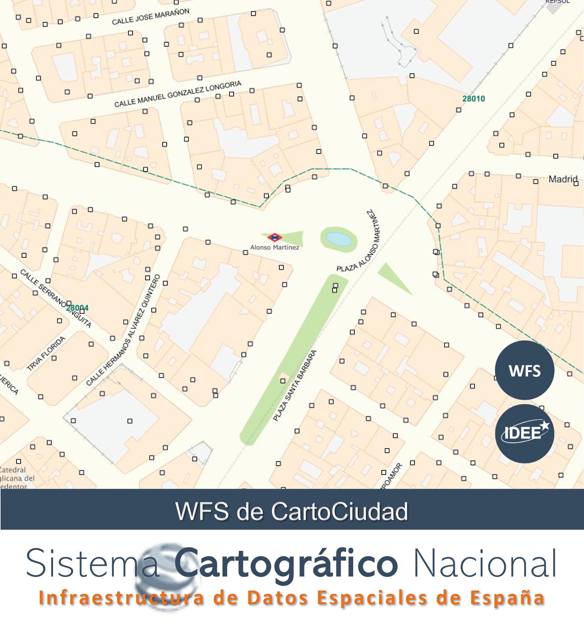
Servicio de descarga (WFS). Direcciones de Redes de Transporte de España (CartoCiudad)
Download Service (WFS). Spanish Transport Network Addresses (CartoCiudad)
Servicio de acceso y localización de direcciones y la consulta de nombres de unidades administrativas, códigos postales y nombres de viales de España. Las direcciones postales procedentes de datos oficiales de La Red de Transporte de la Información Geográfica de Referencia del SCNE, de su red viaria. Aporta las vías interurbanas (red de carreteras, caminos, sendas) con sus puntos kilométricos y las vías urbanas con los portales ubicados a borde de parcela. La red de cobertura nacional fue generada por el IGN a partir los datos de esta temática existentes en sus productos y su contraste con terceras fuentes, y tras la incorporación de la producción de datos realizada por el Instituto Cartográfico de Valencia (ICV) en el ámbito de la Comunidad Valenciana. La actualización de la cobertura nacional de la red se realiza a partir de fuentes de datos procedentes de la Administración General del Estado y de las Comunidades Autónomas, y, en particular, por la integración de la actualización realizada el ICV en la C. Valenciana y por el Eusko Jaurlaritza - Gobierno Vasco en el País Vasco. A estas direcciones postales se les ha asignado sus correspondientes unidades administrativas del Registro Central de Cartografía y códigos postales de Grupo Correos. Los objetos geográficos (direcciones, unidades administrativas, códigos postales, nombres de las viales) son conformes a la especificación de datos sobre direcciones de INSPIRE del Anexo I.
Nota: Servicio de descarga Inspire de acceso directo conforme con ISO 19142 Web Feature Service e ISO 19143 Filter Encoding.
Address access and location service, as well as the query of administrative unit names, postal codes, and road names in Spain. Postal addresses are derived from official data from the SCNE's Geographic Reference Information Transport Network (SCNE) for its road network. It provides routes (road networks, paths, and trails) with their kilometer points, and urban roads with the entrances located at the edge of each plot. The national coverage network was generated by the IGN (National Institute of Statistics and Census) based on the data on this subject found in its products and compared with third-party sources. The network's national coverage was incorporated after incorporating data produced by the Cartographic Institute of Valencia (ICV) in the Valencian Community. The network's national coverage is updated using data sources from the General State Administration and the Autonomous Communities, and, through the integration of the update performed by the ICV in the Valencian Community and by the Eusko Jaurlaritza (Basque Government) in the Basque Country. These postal addresses have been assigned their corresponding administrative units from the Central Cartography Registry and postal codes from Grupo Correos. The geographic features (addresses, administrative units, postal codes, and street names) conform to the INSPIRE address data specification in Annex I.
Note: The INSPIRE direct access download service complies with ISO 19142 Web Feature Service and ISO 19143 Filter Encoding.
Simple
Identification info
Información de Identificación
-
Date (Creation)Fecha (Creación)
- 2013-09-25
-
Citation identifierIdentificador del Contacto
- SCNE / wfs_cartociudad_address
- Point of contact
-
Organisation name Individual name Electronic mail address Role Infraestructura de Datos Espaciales de España (IDEE)
Spanish Spatial Data Infrastructure (IDEE)
Point of contactPunto de Contacto
-
INSPIRE_SpatialDataServicesClassification
-
-
infoManagementService
-
infoFeatureTypeService
-
-
WebServicesSpecification
-
-
2.0.0
-
WFS
-
OGC
-
- Keywords
-
-
Puntos Kilométricos
-
Portales
-
Cartociudad
-
IDEE
-
Infraestructura de Datos Espaciales
-
Sistema Cartográfico Nacional
-
SCNE
-
-
Access constraintsRestricciones de Acceso
-
Other restrictionsOtras restricciones
-
Otras limitaciones
-
Sin limitaciones al acceso público.
-
Use constraintsRestricciones de uso
-
Other restrictionsOtras restricciones
-
Otras limitaciones
-
CC-BY 4.0 scne.es
-
Service TypeTipo de Servicio
- download
))
-
Coupling TypeTipo de acoplamiento
-
TightApretado
- Contains Operations
-
Operation Name Distributed Computing Platforms Connect Point GetCapabilities
Web servicesServicios webhttps://www.cartociudad.es/wfs-inspire/direcciones?request=GetCapabilities&service=WFS DescribeFeatureType
Web servicesServicios webhttps://www.cartociudad.es/wfs-inspire/direcciones?request=DescribeFeatureType&service=WFS&version=2.0.0 ListStoredQueries
Web servicesServicios webhttps://www.cartociudad.es/wfs-inspire/direcciones?request=ListStoredQueries&service=WFS&version=2.0.0 DescribeStoredQueries
Web servicesServicios webhttps://www.cartociudad.es/wfs-inspire/direcciones?request=DescribeStoredQueries&service=WFS&version=2.0.0 GetFeature
Web servicesServicios webhttps://www.cartociudad.es/wfs-inspire/direcciones?request=GetFeature&service=WFS&version=2.0.0 GetPropertyValue
Web servicesServicios webhttps://www.cartociudad.es/wfs-inspire/direcciones
-
Identificador único del recurso
-
ETRS89 en la Península, Illes Balears, Ceuta y Melilla. Coordenadas geográficas longitud y latitud.
- Distribution format
-
Name Version gml+xml3.2
- OnLine resource
-
Protocol Linkage Name OGC Web Feature Service https://www.cartociudad.es/wfs-inspire/direcciones?service=WFS&request=GetCapabilities&version=2.0.0 Servicio de descarga de Direcciones INSPIRE del proyecto CartoCiudad
-
Hierarchy levelJerarquía
-
ServiceServicio
- Other
-
Servicio web de datos espaciales. Servicio de descarga
Conformance result
Conformidad del Resultado
Conformance result
Conformidad del Resultado
-
Date (Publication)Fecha (Publicación)
- 2010-12-08
Citation identifier
Identificador del Contacto
-
Explicación
-
Conforme
-
PassAprobado
- Yes
Conformance result
Conformidad del Resultado
Metadata
-
File identifierIdentificador del fichero
- spaignwfs_cartociudad_address XML
-
Metadata languageIdioma de los metadatos
- Spanish; Castilian
-
Hierarchy levelJerarquía
-
ServiceServicio
- Hierarchy level name
-
Servicio
-
Date stampFecha
- 2025-11-20T12:13:33.236069Z
- Metadata standard name
-
Reglamento (CE) Nº 1205/2008 de INSPIRE
- Metadata standard version
-
TG 2.0
- Metadata author
-
Organisation name Individual name Electronic mail address Role Infraestructura de Datos Espaciales de España (IDEE)
Spanish Spatial Data Infrastructure (IDEE)
Point of contactPunto de Contacto
- Other language
-
Language Character encoding EnglishEnglishUTF8UTF8Spanish; CastilianSpanish; CastilianUTF8UTF8