 Catálogo de metadatos de la Infraestructura de Datos Espaciales de España
Type of resources
INSPIRE themes
Organization
Service types
-

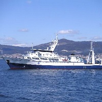
The marine ecosystem of the island of El Hierro, one of the richest and most sensitive of the spanish region, is experiencing the consequences of the first recorded underwater eruption in the Canary Islands in the last 500 years of volcanological history. The principal objective of VULCANO is to characterize the marine ecosystem from a physical-chemical-biological approach in order to quantify the environmental impact caused by the eruptive process. This main aim splits into five particular objectives: 1) to characterize the ecosystem before and after the eruption process, 2) to study the spatio-temporal variability of physical, chemical and biogeochemical properties, 3) to evaluate the impact of the eruptive process on lower trophic levels and 4) Characterization of the physiographic, morphological and structural changes on the seafloor associeted to submarine eruptions and 5) the data integration in existing databases, SIG implementation and dissemination by viewers. These objectives will be accomplished through the development of a multidisciplinary working plan which includes the realization of 3 oceanographic cruises and satellite observations.
-

Study of the edge of Spanish Platform on the Canary Islands Basin.
-
Study of the edge of Spanish Platform on the Canary Islands Basin.
-
Prospecting Scomber scombrus and Trachurus trachurus eggs and adult catches to estimate egg production and fecundity of Scomber scombrus for joint international evaluation of spawning stock biomass of mackerel by the method annual egg production (MPAH) and production eggs Trachurus.
-
The objective of the project RADIALES, formulated in 1990, aims at “understanding and modelling the response of the marine ecosystem to the sources of temporal variability in oceanographic and planktonic components, particularly foccusing in those factors and processes affecting biological production and potentially altering the ecosystem services”. This project represents the oldest multidisciplinary ocean observation initiative still active in Spain.
-
FICARAM cruise aims to investigate the evolution of decadal anthropogenic carbon and to evaluate the CO2 uptake capacity in the sector South Atlantic Ocean and its spread to Ecuador and Nord-tropical zone. The section of this cruise is a repeat section following the trace made in 1994 by IFREMER (Laboratoire de Physique des Oceans) into the French project CITHER as a WOCE (http://wwz.ifremer.fr/lpo/Moyens-a-la-mer/Les-campagnes-a-la-mer/Cither-2). This section was repeated in 2001 and 2002 by the Oceanology Group of the Instituto de Investigaciones Marinas of CSIC as part of CAVASSO and CARBOOCEAN European projects. This section is part of the international programs GOSHIP (http://www.go-ship.org/CruisePlans.html) and IOPCC. These programs allow the coordination between the various activities in the global ocean (http://www.go-ship.org/RefSecs/GOSHIPMap_April2011.pdf). The objectives of this cruise are framed in the EU FP7 project CARBOCHANGE (http://carbochange.b.uib.no/) under grant agreement nº 264879. Another important component of FICARAM cruise aims examine the biological and biogeochemical mechanisms that hinder total dissolved organic carbon (DOC) remineralisation in marine systems, taking a multidisciplinary perspective and applying many different approaches. This objective is the global objective of the Spanish project DOREMI that join this FICARAM cruise. Along the section, the DOREMI project will test the effect of different factors (carbon and nutrient additions, and microbial structure) on DOC degradation in epipelagic, mesopelagic and deep waters, developing some experiments determining the potential degradability of mesopelagic and epipelagic DOM, and the role that labile C supplements plays regulating this process and by the microbial structure.
-
In January 2012, a physical-geological mooring was installed to the East of Elephant Island onboard the RV Hesperides. The mooring was constituted by current meters, temperature, conductivity, and pressure sensors located at selected depths. The mooring was deployed for one year period, and successfully recovered on January 23rd 2013 during the Hesperides Antarctic Survey 2012-2013. The goal of the experiment is to monitor the presence / absence of the Antarctic slope front over the southern slope of the South Scotia Ridge. The addition of a sediment trap will allow to identify the terrigenous / biogenic composition of the flow suspended particles. In an international context, the collected data will be used to optimize the MITgcm Antarctic regional model (ECCO2/ECCO3 project, JPL/Caltech).
-
The objectives of the DETSUFA cruise (BIO Hespérides 04/03–17/03/2013) are (1) to evaluate the footprint in the seafloor of a series of earthquake-generated subaerial landslides that took place in Fiordo de Aysén, Chile, in 2007, which entered the seawater generating a number of destructive tsunamis which killed 10 and produced significant damage in the local infrastructure, (2) to reconstruct the morphology and dynamics of these landslides in order to obtain input data for tsunami modelling, and (3) to determine the occurrence of similar episodes in the past that might have generated other tsunamis, in order to establish a possible recurrence period of such events. The cruise fits within the global scientific interest stirred up by tsunamis in general, being the Fiordo de Aysén a highly relevant analogue for the understanding of this kind of events occurring in semi-enclosed basins such as fjords, lakes or water dams, which often harbour large human population and infrastructures.
-
Ámbito de aplicación del Plan de Recuperación del águila azor perdicera (Hieraaetus fasciatus = Aquila fasciata) en Aragón. Territorios en los que se aplica el Plan de Recuperación del águila azor perdicera en Aragón. Delimitación oficial a 8 de julio de 2013
-

Seguimiento de variables oceanográficas (fisico,quimico y biologicas) a lo largo de puntos singulares del litoral mediterraneo español.