Spatial Data Infrastructure of Spain
COVID-19

RESOURCES
Open resources on COVID-19
Because of the scope and severity of the COVID-19 pandemic and the huge importance of spatial data infrastructures in the management of this crisis, now more than ever it is crucial to provide access to all the resources that can be useful for users and to facilitate decision-making.
Following is a list of resources that have been published from different administrations and international agencies.
For notifications on new developments or other resources that you think should be included on this list, we would appreciate it if you would contact us at idee@mitma.es
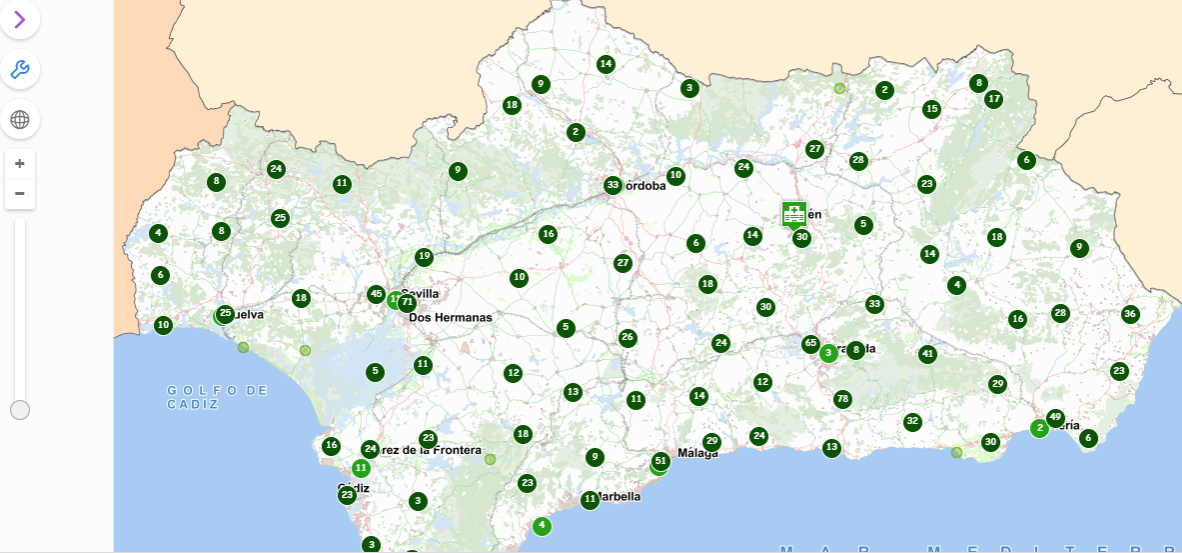 |
The Institute of Statistics and Cartography of Andalusia (IECA) has published a page with alphanumeric and geographic information on COVID-19. Including a viewer in which different variables can be seen, such as population distribution by age ranges and many points of interest with related information including hospitals and primary care centres.
|
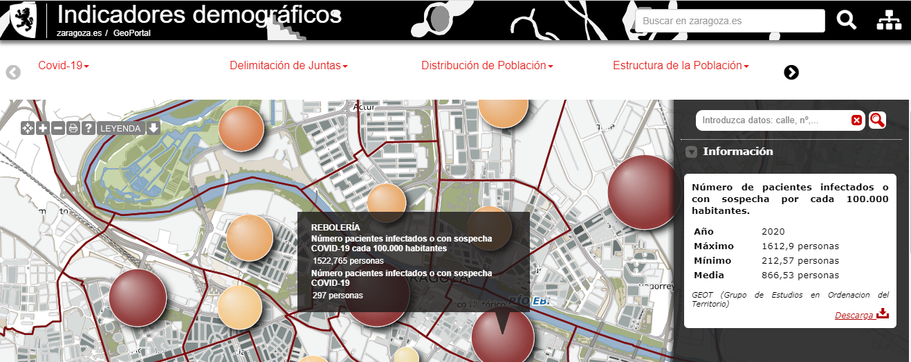 |
The Zaragoza City Council has published a series of geospatial resources on its website prepared by the Chair for Territory, Society, and Geographical Visualisation of the Zaragoza City Council along with the GEOT group from the University of Zaragoza, about the current situation of the pandemic, with data by Basic Health Area both in the city of Zaragoza and in Aragon.
|
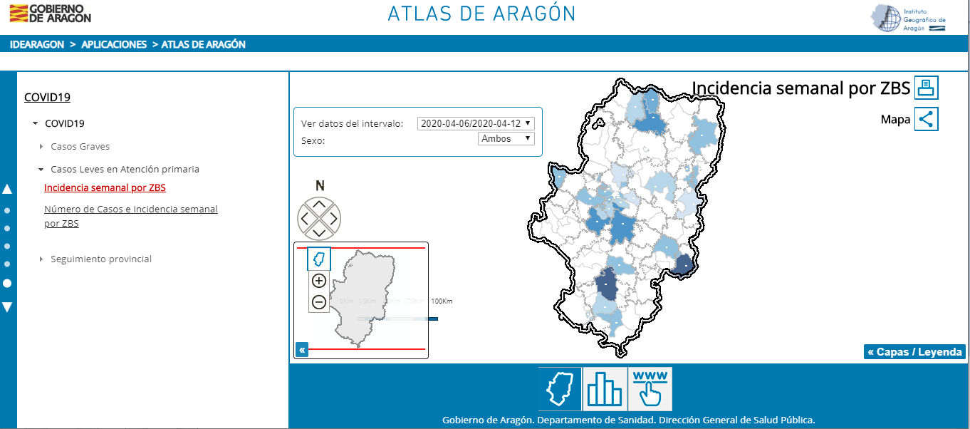 |
The Government of Aragon has published, in its Atlas, information on COVID-19 regarding serious cases and mild cases in primary care.
|
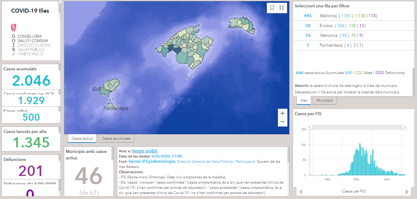 |
The Balearic Islands have also published a dashboard, including a viewer, with various metrics and graphs showing the incidence of COVID-19 by municipalities. |
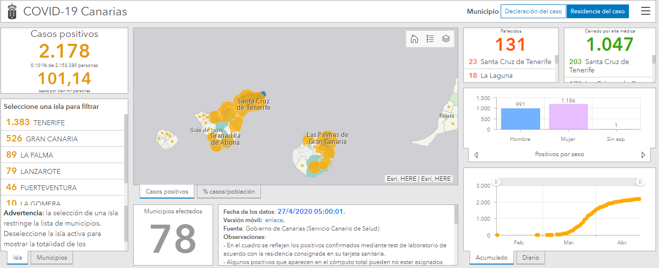 |
GRAFCAN has developed, in co-ordination with the General Directorate for Modernization of the Public Administration Department and with the General Directorate of Public Health, a tool to display COVID-19 data from the Canary Islands. |
 |
The Castile-Leon Autonomous Administration has several geographical information resources related to COVID-19 available to users and which are updated daily. They are available on the open data portal of the Castile-Leon Regional Government and in its geonetwork catalogue.
|
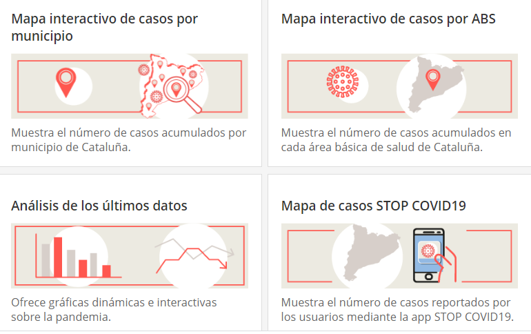 |
Several useful resources are offered from the Department of Health, in Catalonia:
|
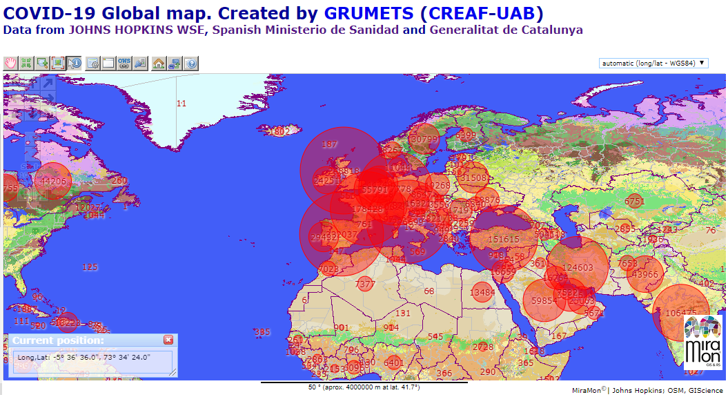 |
CREAF has used MiraMon Map Browser technology, which uses interoperable OGC services, to create a map on the state of COVID-19 in the World, Spain and Catalonia with data updated daily thanks to data provided by the JOHNS HOPKINS Whiting School of Engineering (USA), the Spanish Ministry of Health and the open data portal of the Government of Catalonia. It includes not only totals but also increases or trends in recent days. Data can be consulted by date. |
 |
Several data sets related to COVID-19 have been published on open data portal from the Government of Catalonia , including from several private organizations that have provided their data. They cover aspects directly related to the evolution of the pandemic as well as the effects it is having on mobility, pollution, ERTEs (temporary employment regulation), or the activity of the administration itself. |
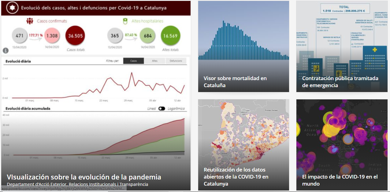 |
On the Open Government website, a specific section on COVID-19 has been created containing applications developed using open data in Catalonia and also worldwide. |
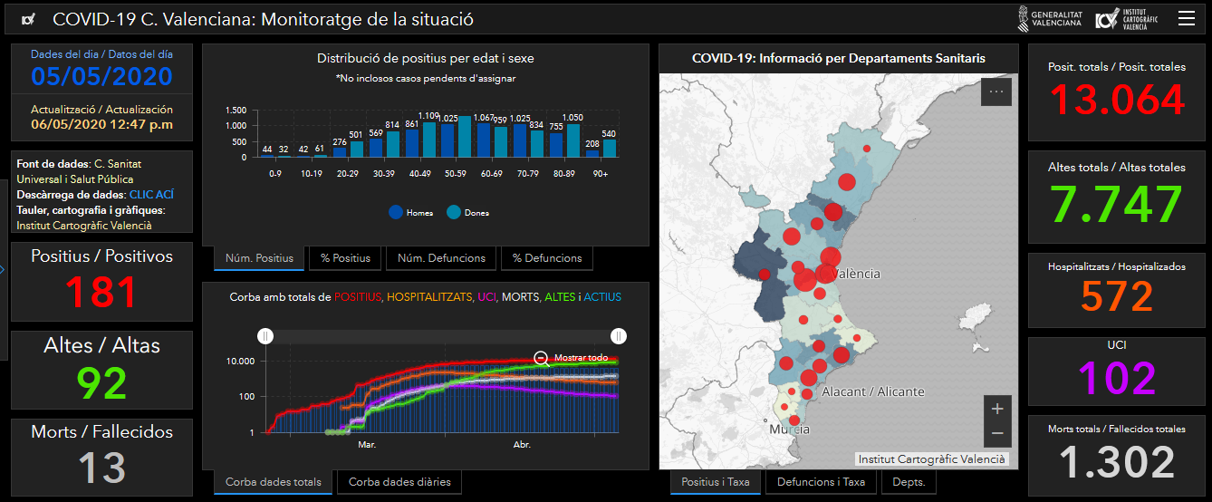 |
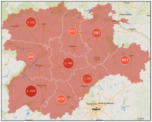
The Generalitat Valanciana publishes interesting figures accompanied by a viewer and various graphs showing the incidence of COVID-19 in the community. |
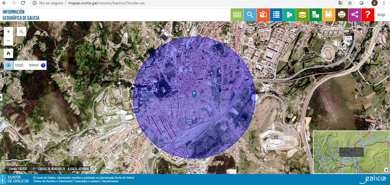 |
To help citizens consider authorized travel during the de-escalation of containment measures, the Regional Government of Galicia has promoted a digital tool to check distances. The tool can be accessed through the basic viewer available on the Galicia geographic information website. |
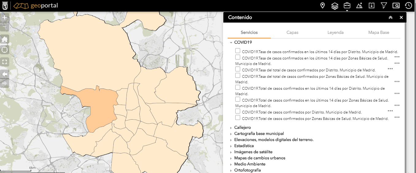 |
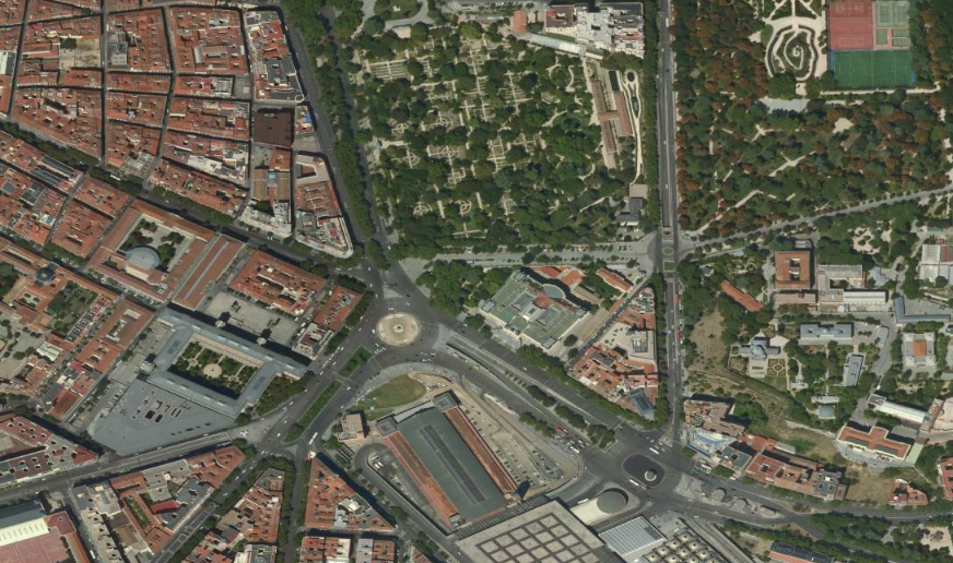
The Madrid City Council has published information about COVID-19 on its Geoportal via OGC services. You can see several layers of information with the viewer.
|
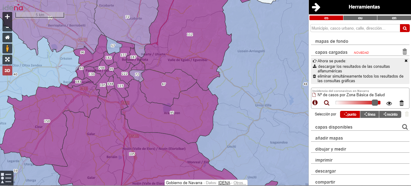 |
The Government of Navarre has published a page with alphanumeric and geographical information about COVID-19.
More information on the IDEE Blog |
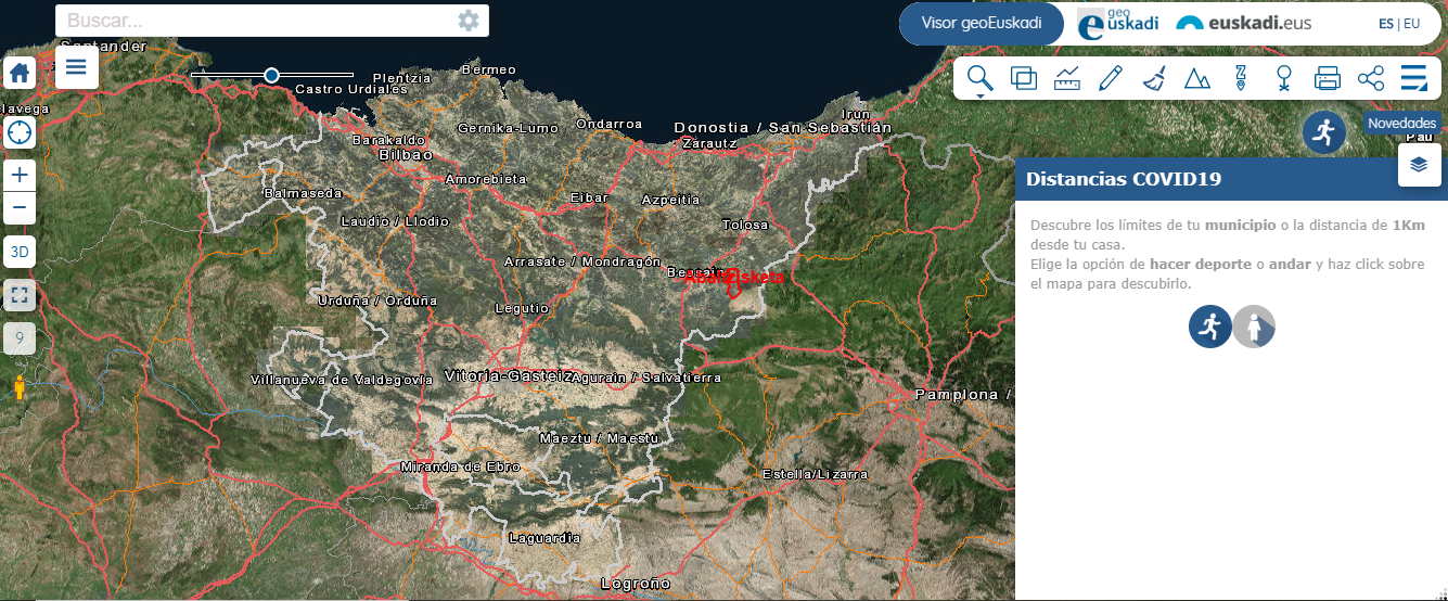 |
From Geoeuskadi, a viewer is provided in which you can see municipal boundaries and a distance of 1Km from a specific location. They have also published a dynamic report showing, among others, the rate of positive cases, hospital discharges, or deaths in the provinces and municipalities of the Basque Country.. |
 |
The Data sets from Euskadi Open Data are very useful.
More information can be found on the website at https://opendata.euskadi.eus/ |
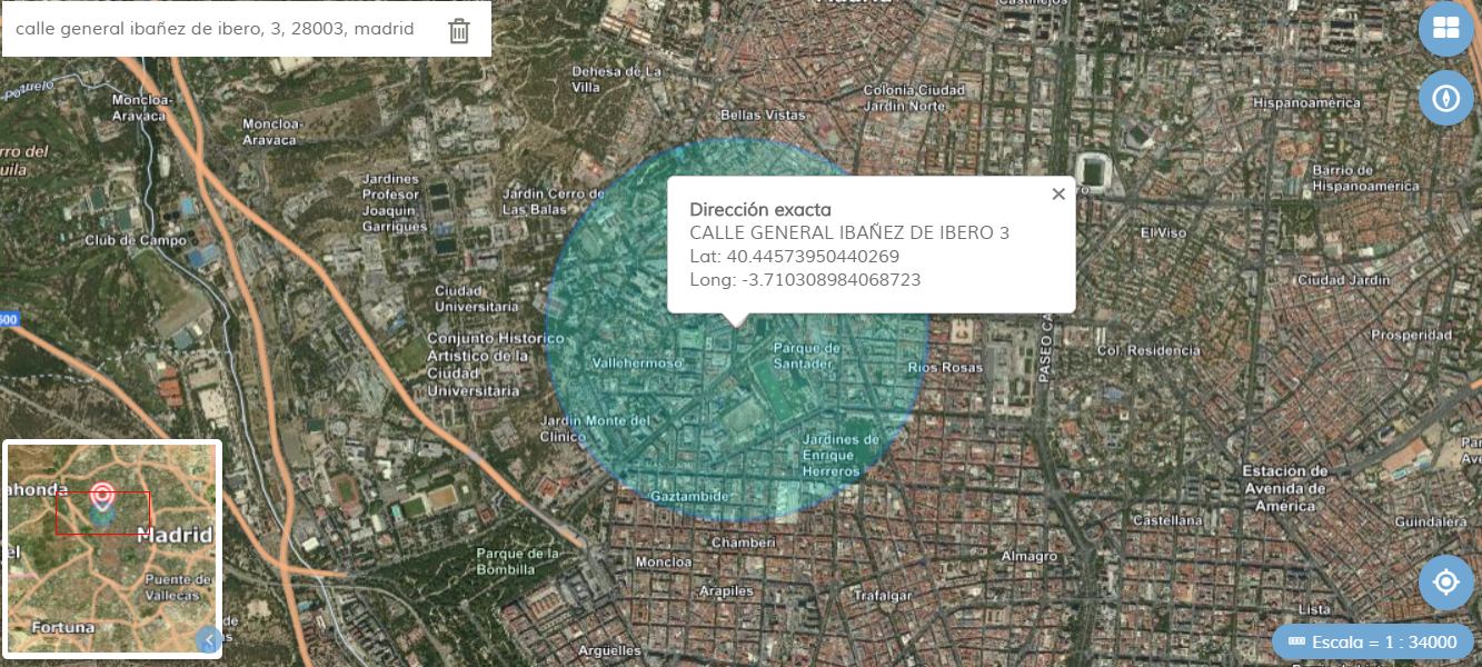 |
The National Geographic Institute (IGN) has published a viewer showing a 1km radius from a location. This can be obtained with a search by postal address, by geopositioning the device, or by clicking anywhere on the map. It is very useful to learn about the area in which children under the age of 14 can move once the first steps for de-escalation have been approved. |
 |
La Dirección General de Transporte Terrestre ha publicado un visualizador interactivo que muestra puntos de restauración y tiendas con venta de comida preparada. Se muestran datos de ubicación, la carretera y el punto kilométrico en le que se encuentran, el horario, el tipo de comida (bocadillos, bebidas calientes, comida preparada) y si disponen de duchas. |
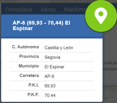 |
La Dirección General de Carreteras ha publicado un visualizador que muestra información de las Areas de Descanso: comunidad autónoma, provincia, municipio, carretera y punto kilométrico inicial y final.
|
 |
La IDEE ha implementado varios recursos basados en los servicios estándar, en concreto los siguientes servicios de mapas teselados mapa base y del Plan Nacional de Ortofotografía Aérea (PNOA).
|
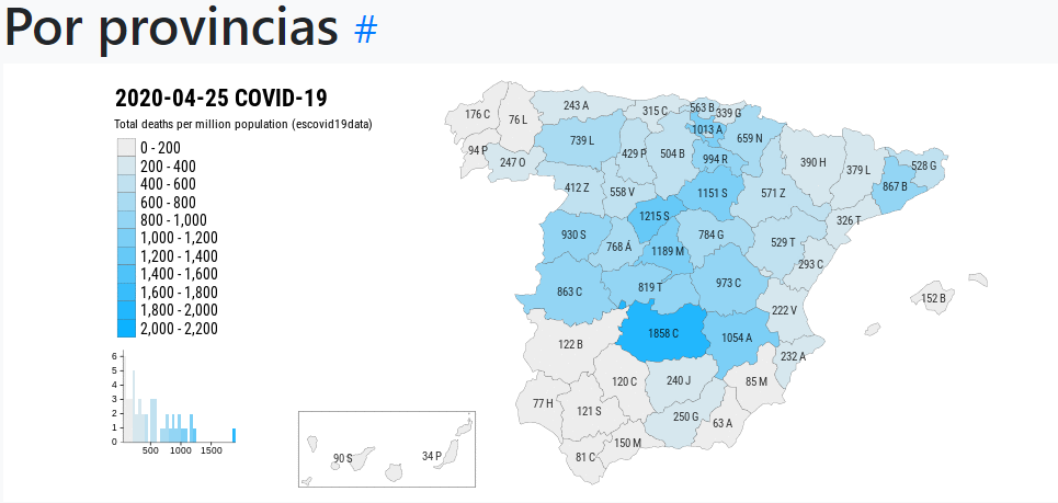 |
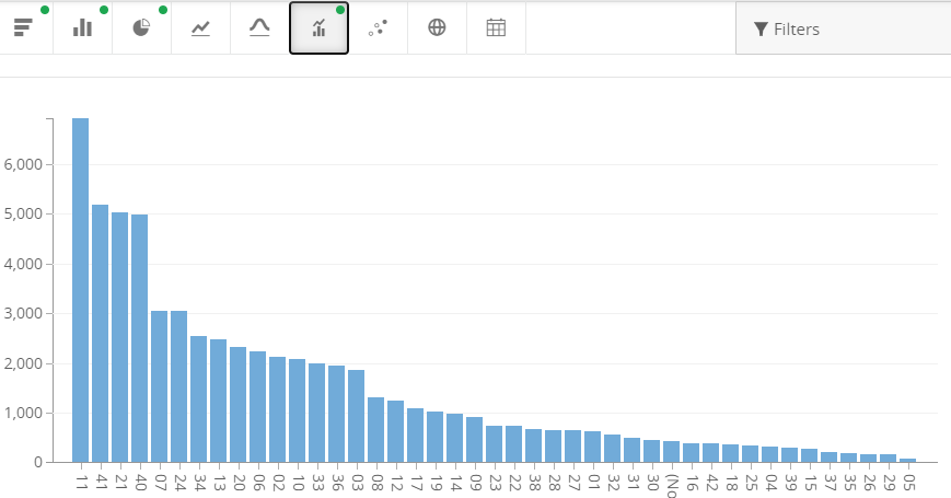
The company Montera34 has published a webpage showing graphs updated daily with COVID-19 data collected in the collaborative project Escovid19data.
|
 |
The OGC website also provides several resources to have a better understanding of the impact of COVID-19. They offer base map resources, information specific to COVID-19, graphic representations of indicators, various tips and cartographic examples, etc.
|
 |
Internationally, observations from Earth are being used to respond to the problems arising in regard to recovery from the COVID-19 pandemic. GEO has published a repository to share information and data that will be updated on an ongoing basis.
|
 |
The European data portal has created a special section dedicated to COVID-19 to give visibility to all pandemic-related initiatives.
|